Our cities are constantly changing – but how often does a whole suburb disappear off the map? Cribb Island, affectionately known as ‘Cribbie’, was once the city’s closest beach and a premier holiday destination, before it was resumed for Brisbane Airport.
For millennia, the Traditional Owners have cared for the lands and waters of Brisbane. Prior to European invasion, the swampy mudflats, freshwater estuaries and open woodlands of what became Cribb Island were important grounds for trading, hunting and camping. Today, the area continues to hold great local significance.
In 1863, soon after Brisbane opened to free settlement, businessman John George Cribb purchased 150 acres of coastal land from the Queensland Government. Paying 160 pounds, he sought to develop the land for farming. As was common at the time, he named the newly acquired lot after himself, giving birth to ‘Cribb Island’.
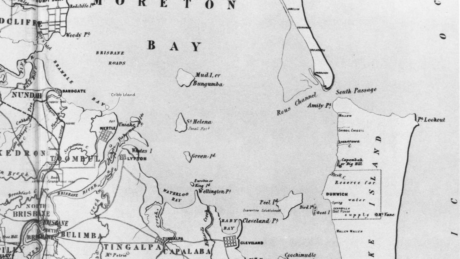
Situated 16 kilometres north-east of Brisbane’s CBD, just north of the mouth of the river, Cribb’s lot faced the calm waters of the Quandamooka region (Moreton Bay). At high tide, flooded creeks and mudflats would isolate the coastal strip from the mainland. So, although Cribbie was not a true island, it was referred to as such.
In 1885, Cribb sold 65 acres of the lot to a young James Jackson, who went on to operate the successful fruit plantation and cannery, Bramble Farm, with his wife Ella. Before long, the Jacksons began accommodating holidaymakers on their picturesque waterfront. With campers starting to return year after year, the Jacksons decided to lease out sections of the land, on which vacationers began to construct increasingly permanent holiday dwellings. This area on the northern edge of the island became known as Jackson’s Estate.

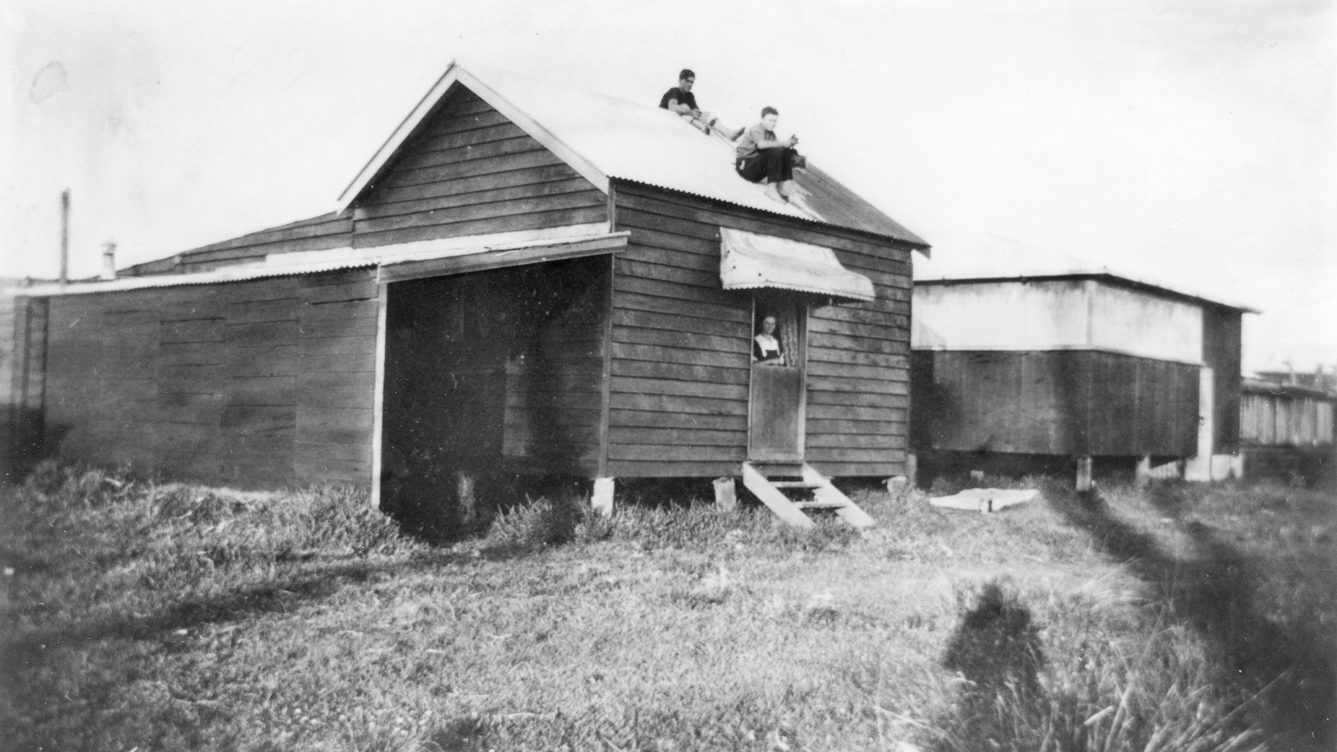
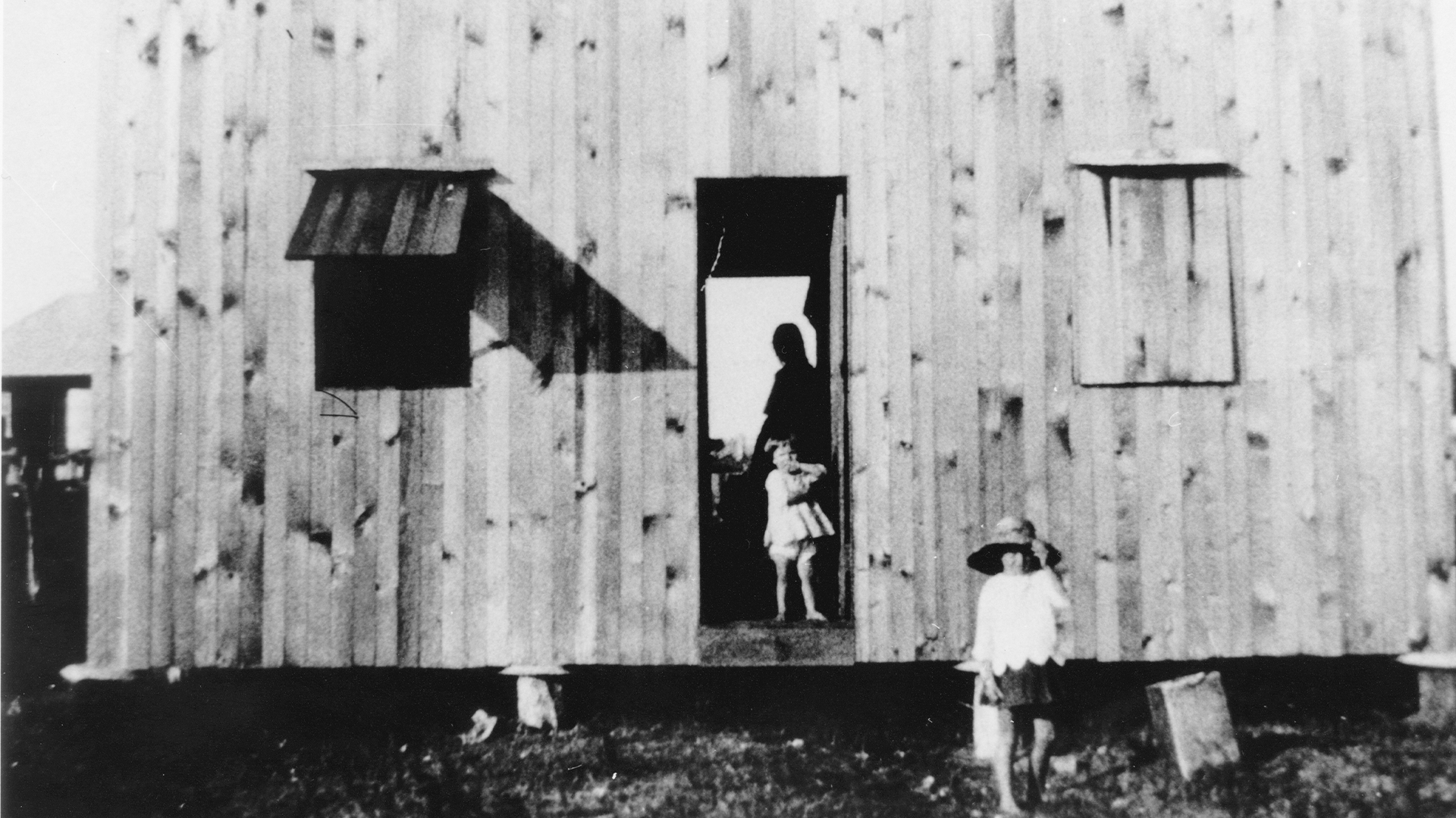
Before long, owner-built weekender accommodation and holiday shacks emerged alongside Queenslander homes. Beach shacks like those at Cribbie were soon a common sight across many of the state’s coastal areas. These low-cost dwellings were constructed from timber and fibro, in addition to found and recycled materials, including car crates.
In 1916, after Cribb died, his remaining land was subdivided and sold. “Cribb’s Island Estate” was advertised by auctioneers as the “nearest watering place to the city”, boasting a “broad sandy beach along [its] whole frontage” and offering “lovely bathing” and “good fishing”. [2]
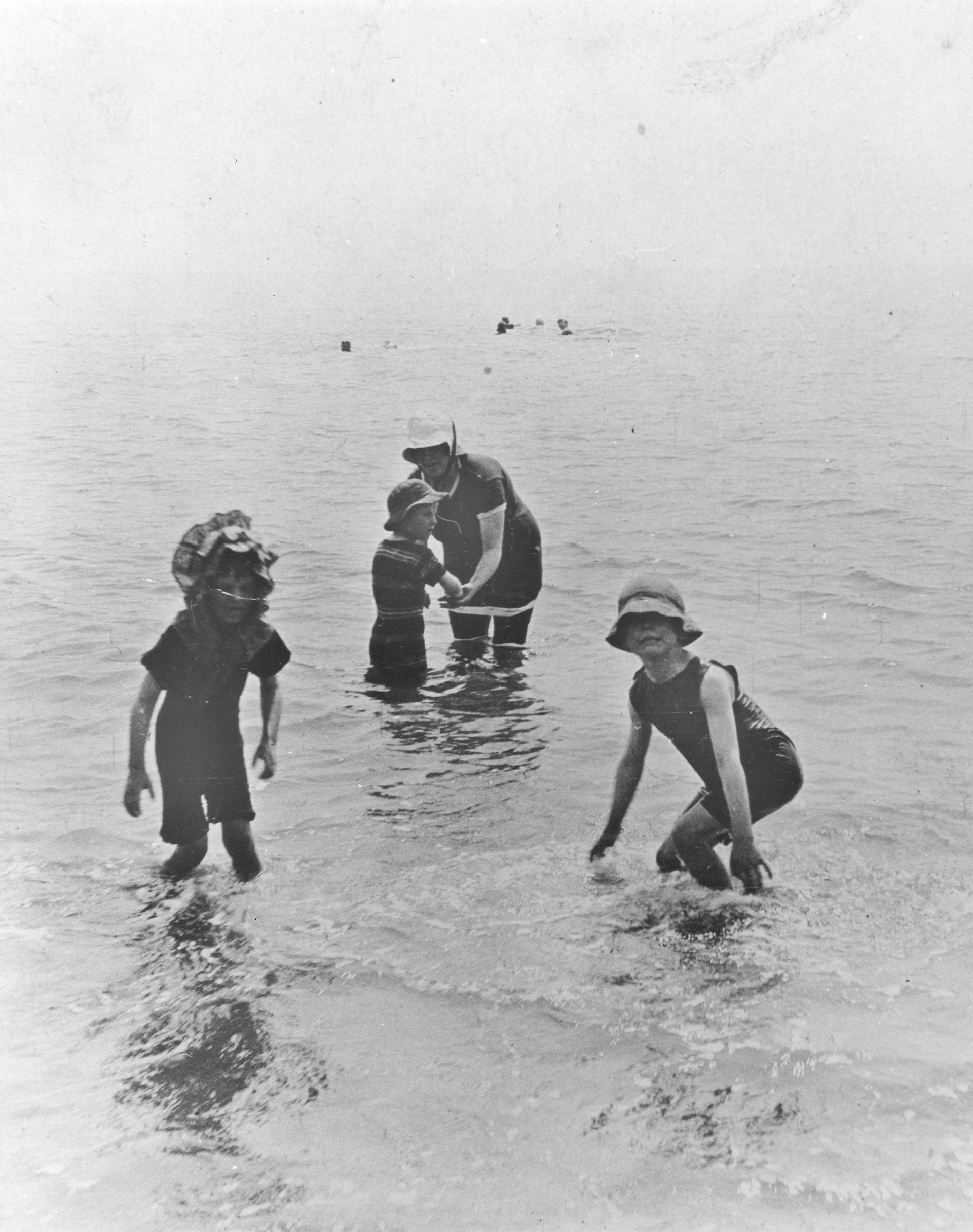
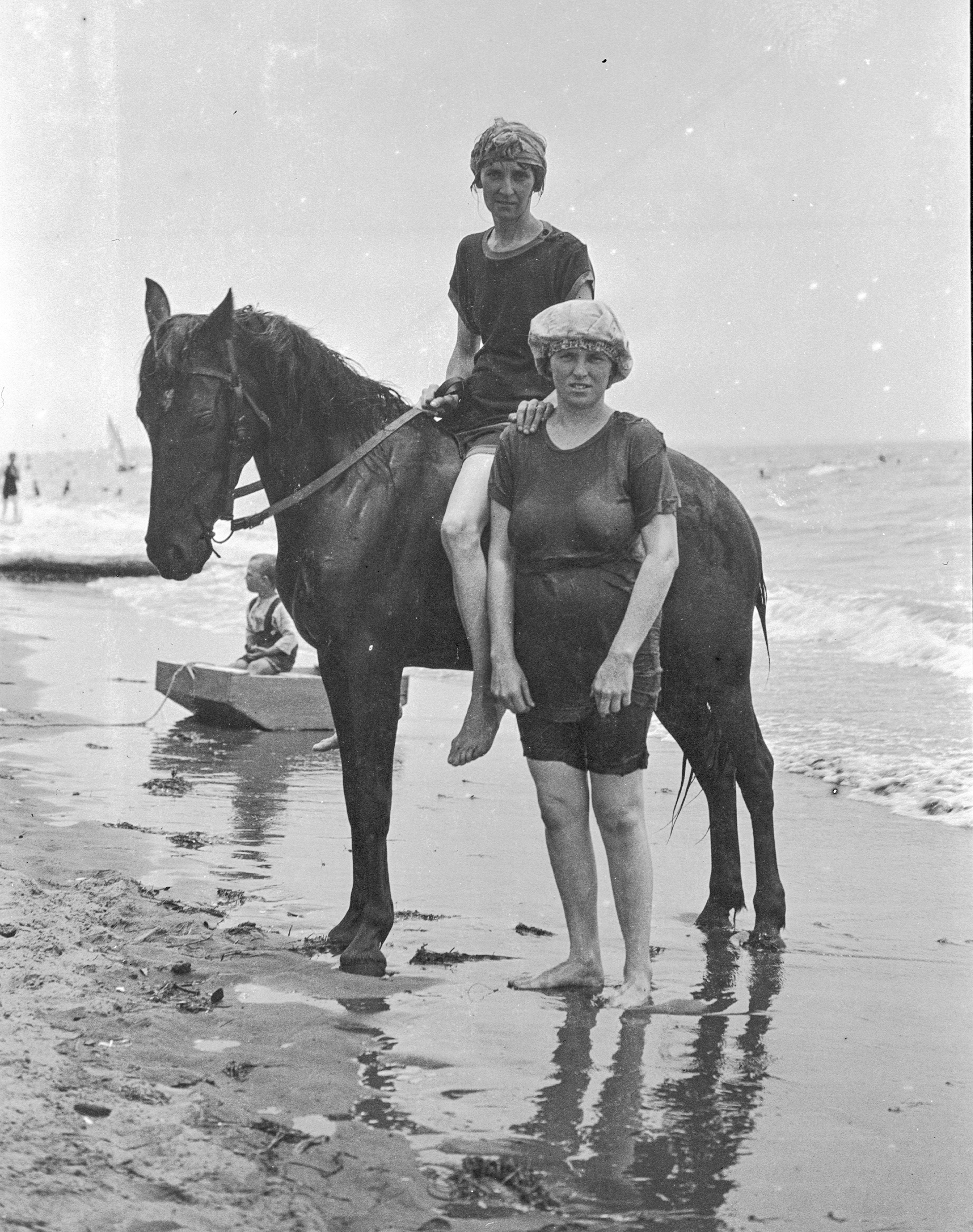
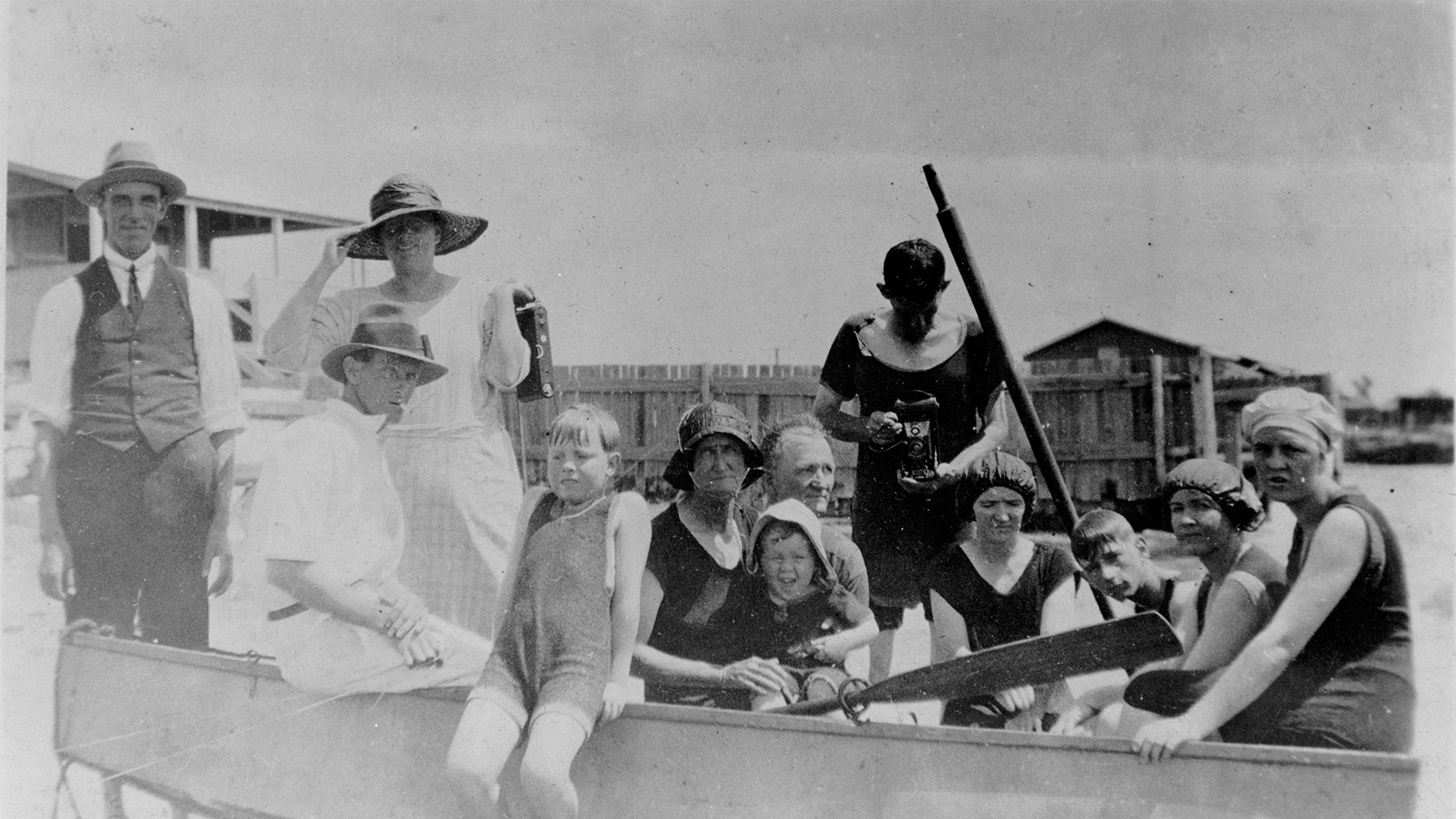
An idyllic seaside location within easy reach of the inner-city suburbs, Cribbie continued to attract many Brisbane families. Warm waters and the sprawling mudflats revealed at a low tide were an ideal playground for children, while teens and adults were entertained by locally-organised, holiday fun programs. At Jackson’s Estate, an open-air hall hosted popular concerts and dances, while the Bramble Farm Social Club organised races, sporting events and theatre shows. Cribbie’s annual sand garden competition – a regular feature of the holiday season at many Queensland beaches – was sponsored by local Brisbane newspapers.
By the 1920s, Cribbie was not only recognised as a premier holiday destination, but also as a suburb. When the Great Depression hit Australia, many Brisbane residents searching for affordable housing found homes here. This period saw the island’s population surge, slowly transforming the beachfront suburb into a tight-knit residential neighbourhood. Like many of the holiday shacks, much of the communal infrastructure was constructed by residents themselves, often within a day’s work. Cribbie was soon home to a post office, police station, school, medical clinic, cinema, kiosk, children’s playground and two churches. A private bus service brought locals to the city and city dwellers to the beach.
As time went on, natural forces and local council regulations began to threaten this beachside bliss. Costal erosion quickened and waterfront homes began to slip into the sea. Attempts to secure the shoreline with car tyres contributed to an increasingly negative image of the suburb. By the end of the 1920s, Council had ordered repairs to any dilapidated and makeshift structures no longer in line with building codes and regulations. Several early beach shacks were also demolished.
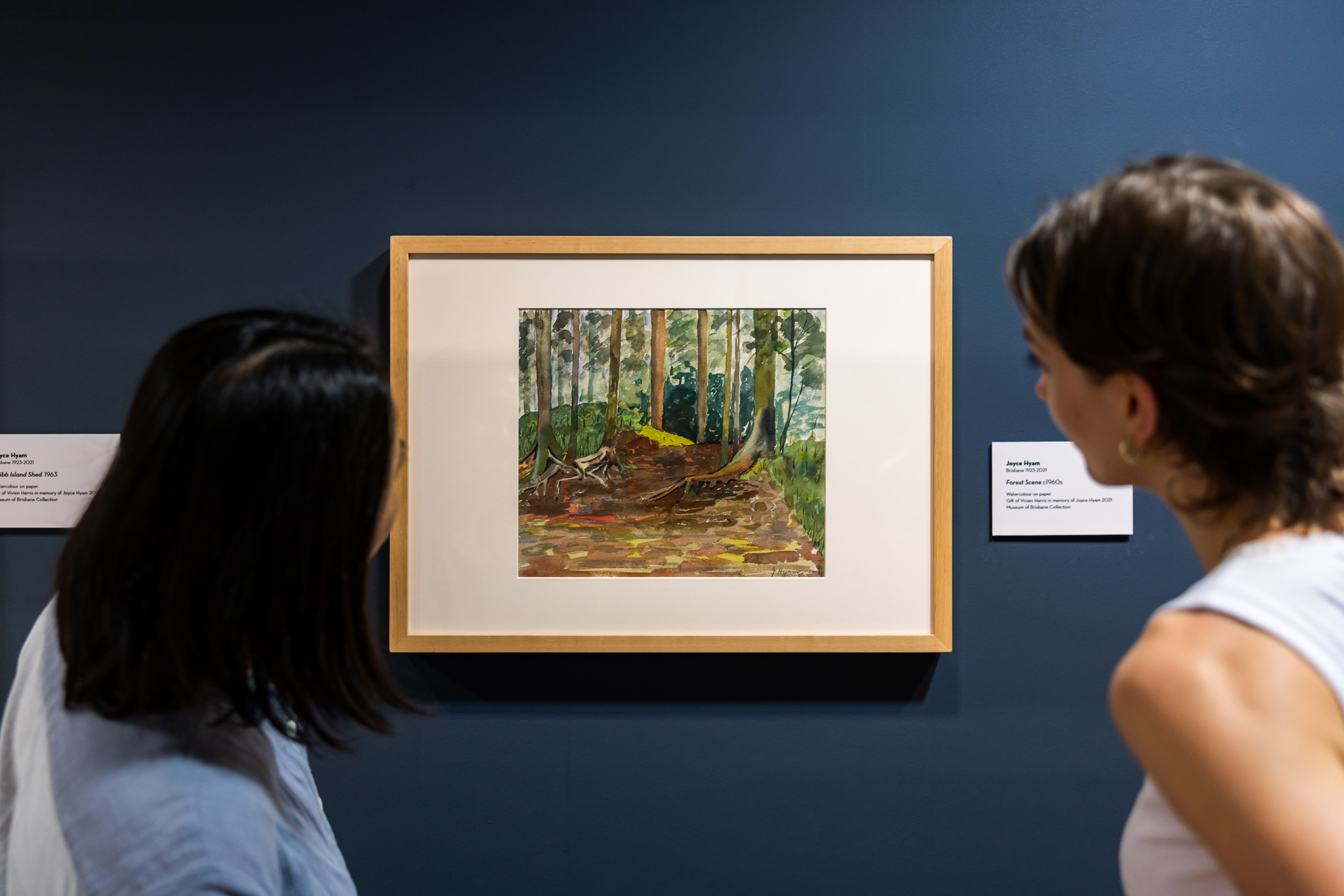
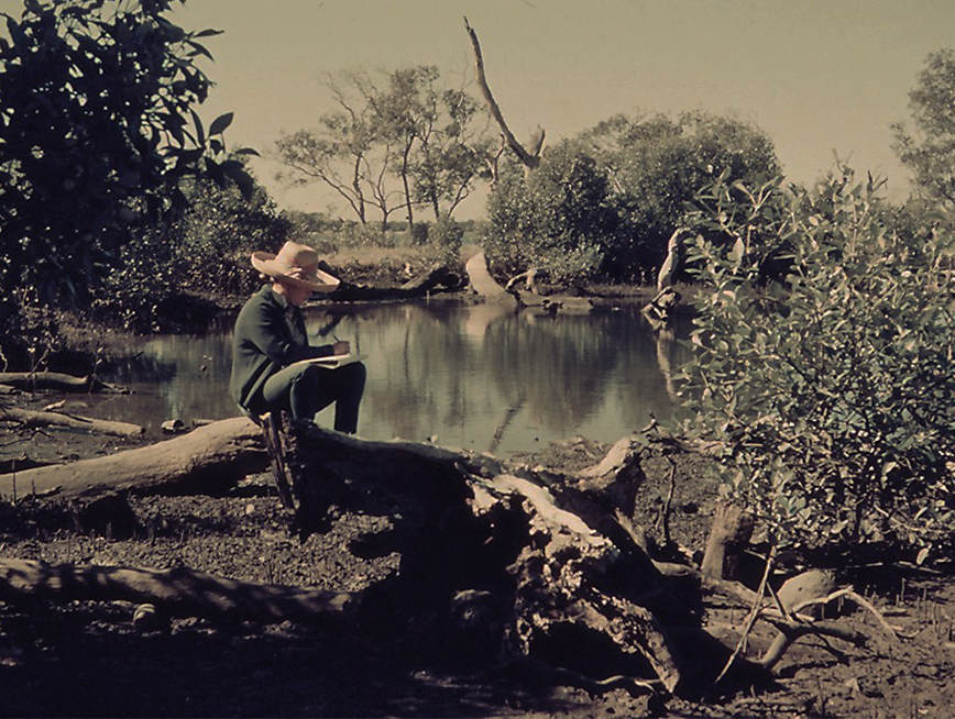
Before long, Cribbie was dubbed the “poor man’s seaside resort” [3] and labelled a “shanty town” [4], to the outrage of residents whose pleas for the construction of a seawall along the foreshore remained unanswered. Artists such as Dr Irene Amos OAM and Joyce Hyam were among those who captured the dilapidated state of Cribb Island in their work. As a child, Hyam holidayed at her aunt’s Cribb Island holiday home during the suburb’s heyday of the 1920s. Returning in the 1960s, Hyam’s emotive watercolours reveal her fascination with Cribbie’s enchanting mangrove swamps and the distinct, weathered architectural remnants that had become characteristic of the suburb. Today, her series is a valuable record of the suburb on the brink of its demise.

After Brisbane’s main airport relocated from Archerfield back to Eagle Farm, following the Second World War, those arriving on a plane would commonly catch a glimpse of Cribb Island. In 1971, a decision was made to expand the airport northward to accommodate increasing air traffic. These plans sealed the fate of Cribb Island. From the early 1970s, the Federal Government resumed land north of the river. The Cribbie community was forced to disperse, with the suburb’s last resident leaving her home in 1980. By the following year, Cribb Island had been removed from official maps and street directories, making it the first suburb in Brisbane’s history to be entirely erased for a new development.
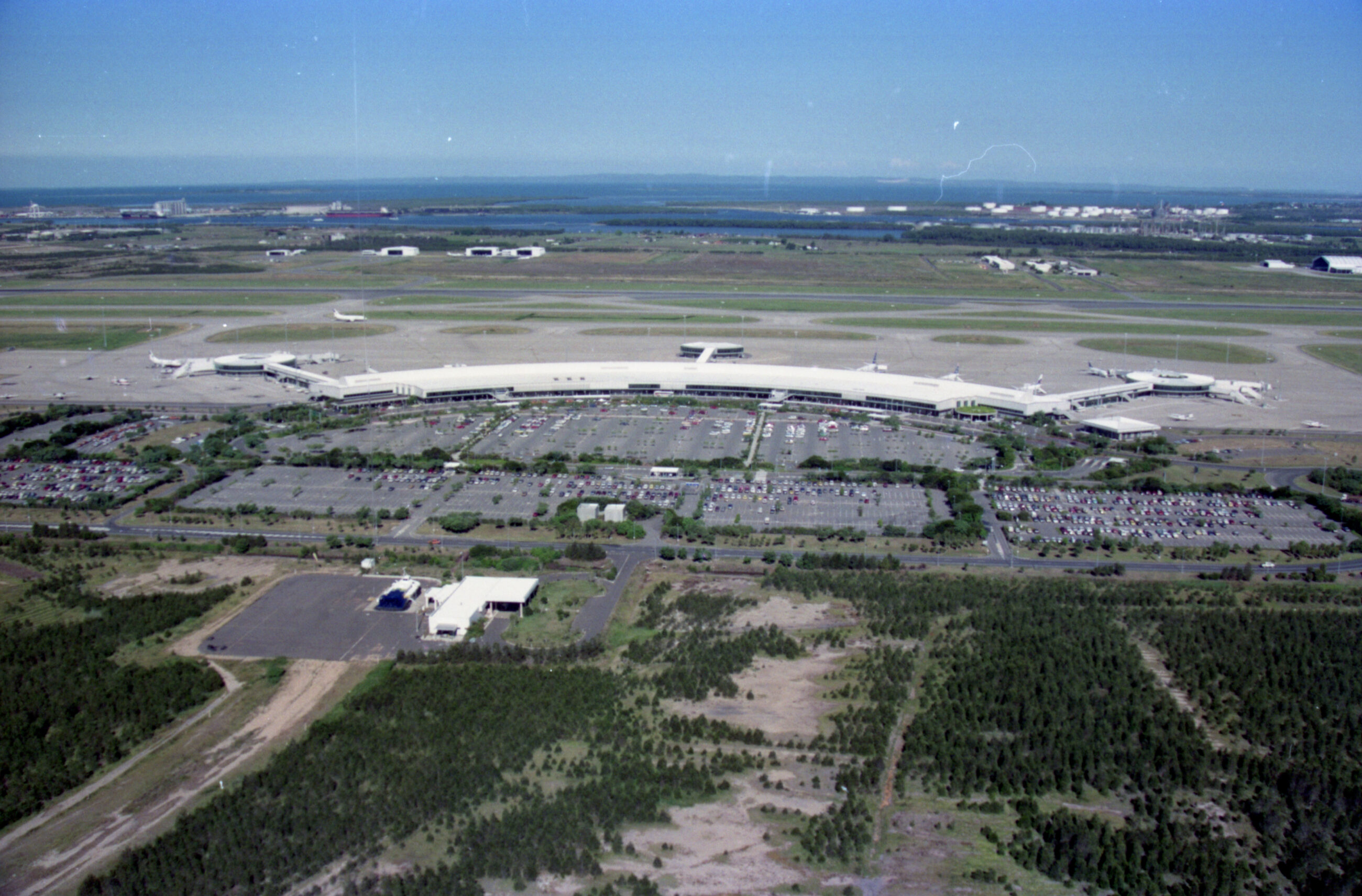
Today, nothing remains of Cribb Island other than some remnants of the foreshore structure and discarded debris beneath the sand. In the hearts and collective memory of many, however, Cribbie lives on; not only as the brief childhood home of the Bee Gees, but as a tight-knit community that shared Moreton Bay as their backyard.
Footnotes
[1] “CRIBB’S ISLAND ESTATE.” The Telegraph (Brisbane, Qld. : 1872 – 1947) 24 April 1916: 8. Web. http://nla.gov.au/nla.news-article177995814.
[2] Cribb’s Island Estate [map]. Brisbane: H.T. James, Lithographer, 1916. https://onesearch.slq.qld.gov.au/permalink/61SLQ_INST/tqqf2h/alma99183686319202061.
[3] “CRIBB ISLAND,” The Sunday Mail, July 28, 1929. https://trove.nla.gov.au/newspaper/article/97695696.
[4] “BRISBANE’S SHANTY TOWN BLOT,” The Sunday Mail, September 1, 1946. https://trove.nla.gov.au/newspaper/article/98378347.